-
DEPARTAMENTOS
- ANIMAIS DE ESTIMAÇÃO
- ARTES
- AUTO AJUDA
-
BEM ESTAR E LAZER
-
CATEGORIAS
-
-
CULINÁRIA E GASTRONOMIA
-
CATEGORIAS
-
-
ESPORTES
-
CATEGORIAS
-
- INFANTIL
-
RELIGIÃO
-
CATEGORIAS
-
- ADMINISTRAÇÃO E NEGÓCIOS
-
CIÊNCIAS BIOLÓGICAS E NATURAIS
-
CATEGORIAS
-
- DIREITO
- ECONOMIA
-
MEDICINA
-
CATEGORIAS
-
-
TODOS DEPARTAMENTOS
-
INTERESSE GERAL
-
LIVROS TÉCNICOS
-
- DISCIPLINAS
- ACESSÓRIOS
- FORMATURA
- PAPELARIA
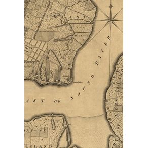
A plan of the city and environs of New York in North America - A Poetose Notebook / Journal / Diary (50 pages/25 sheets
Cód:
491_9781945366192
A plan of the city and environs of New York in North America - A Poetose Notebook / Journal / Diary (50 pages/25 sheets
Autor:
Editora:
Código:
491_9781945366192
Vendido e entregue por Um Livro
The cover of this slim 4" x 6" 50-page notebook of blank pages features a 1776 street map plan of part of New York City. It shows "Road to Kings Bridge where the Rebels mean to make a stand" and "Road to Kepps Bay where the Kings troops landed." It also covers part of Manhattan Island up to present-day 14th Street and parts of Long Island. From The Universal Magazine of Knowledge and Pleasure, London, November 1776, volume 59. Image source: Library of Congress, Geography and Map Division. Here is some of the theory behind the beauty and potential of a blank page: "A person can get lost trying to find a home in herself—but then you simply begin to go on as one must go on, and maybe you say a little something to yourself every once in a while just to practice being with words, meeting silence, meeting yourself again, and maybe you frequent empty rooms to familiarize yourself with the meaning of space as in a blank page, and yourself in it, and maybe you scribble like this will help you come home to yourself, but eventually you fit things together, and what made no sense finds its way into something plausible by virtue of its sheer existence." Image source: Library of Congress, Geography and Map Division.
Veja mais


